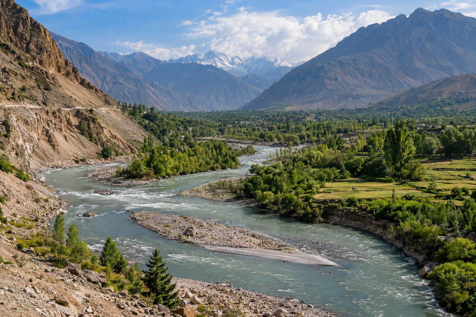
Rivers are among the most powerful natural forces on Earth. A river may look calm and peaceful when we see it flowing through a valley or across a plain, but over long periods of time it can completely change the shape of the land around it. Rivers cut into mountains, carry soil and rocks, create valleys, build floodplains, form waterfalls, and even create new land near the sea.
The process happens slowly in most places, which is why we do not always notice it. However, if we look at the landscape over hundreds, thousands, or millions of years, the effect of rivers becomes very clear.
Understanding how rivers change the shape of the land helps us understand many natural features that we see around the world. Valleys, canyons, deltas, meanders, waterfalls, and floodplains are all connected to the movement of river water.
In simple words, rivers reshape the land through three main processes. These are erosion, transportation, and deposition.
Let us explore how each process works and how rivers gradually create some of the most beautiful landscapes on Earth.
How Rivers Begin
Most rivers begin in high areas such as mountains, hills, or plateaus. Water from rainfall, melting snow, springs, and underground sources collects and begins to flow downhill because of gravity.
Small streams join together and form larger streams. These streams eventually become rivers.
In the upper part of a river, the land is usually steep. Water moves quickly because gravity pulls it downhill. This fast moving water has a great deal of energy.
As the river travels toward lower land, the slope becomes gentler. The river usually becomes wider and deeper. Its speed may change, and the type of work it does to the landscape also changes.
A river is therefore not the same from its beginning to its end. Different parts of the river create different landforms.
River Erosion Changes the Land
Erosion is one of the most important ways rivers change the shape of the land.
River erosion happens when flowing water wears away soil, rock, and other materials from the river bed and river banks.
Water itself can loosen small particles. However, a river often carries sand, stones, and rocks that make erosion even stronger.
These materials scrape against the river bed and sides like natural tools.
Over time, the river cuts deeper into the land.
This process can create valleys, gorges, canyons, and other landforms.
Even a small river can cause major changes if it flows through the same area for a very long time.
How Rivers Form Valleys
One of the clearest examples of river erosion is the formation of a valley.
In mountainous areas, young rivers often flow quickly down steep slopes. The fast moving water cuts into the ground.
The river usually erodes downward more strongly than sideways during this stage.
As the river cuts deeper, soil and rock from the sides of the channel may fall toward the river.
Eventually, a narrow valley begins to develop.
Many young river valleys have a shape similar to the letter V. For this reason, they are often called V shaped valleys.
The river runs along the bottom of the valley while the valley sides rise steeply on both sides.
These valleys show how water can slowly cut through solid land.
How Rivers Create Canyons
If a river continues cutting downward for a very long time, it may create a canyon.
A canyon is a deep valley with very steep sides.
Canyons often develop in areas where the rock is strong enough to form high cliffs instead of collapsing quickly.
The process can take millions of years.
The Grand Canyon in the United States is one famous example of a landscape shaped largely by river erosion. The Colorado River and other natural processes gradually cut through layers of rock, producing the enormous canyon that exists today.
This example shows that rivers do not need to change the land quickly to have a dramatic effect.
A small amount of erosion repeated for an extremely long period can create an enormous landscape.
Rivers Carry Rock and Soil
Rivers do more than remove material from one location. They also transport it somewhere else.
This process is known as transportation.
A river may carry clay, sand, gravel, stones, and even large pieces of rock.
Very small particles can remain mixed with the water for long distances.
Larger stones often roll, bounce, or slide along the bottom of the river.
The amount of material a river can carry depends mainly on the speed and volume of the water.
A fast river usually has enough energy to move larger pieces of rock.
When the river slows down, it begins to lose some of this energy.
This leads to another important process called deposition.
What Is River Deposition?
Deposition happens when a river drops the material it has been carrying.
If the water becomes slower, it may no longer have enough energy to transport heavy sand, gravel, or stones.
The larger materials are usually deposited first.
Smaller particles may continue travelling farther downstream.
River deposition can gradually create new features on the landscape.
Floodplains, river banks, sand bars, and deltas are all examples of landforms that can be created or influenced by deposition.
This is one reason rivers are both destructive and constructive.
They remove land in some places but build new land in others.
How Meanders Form
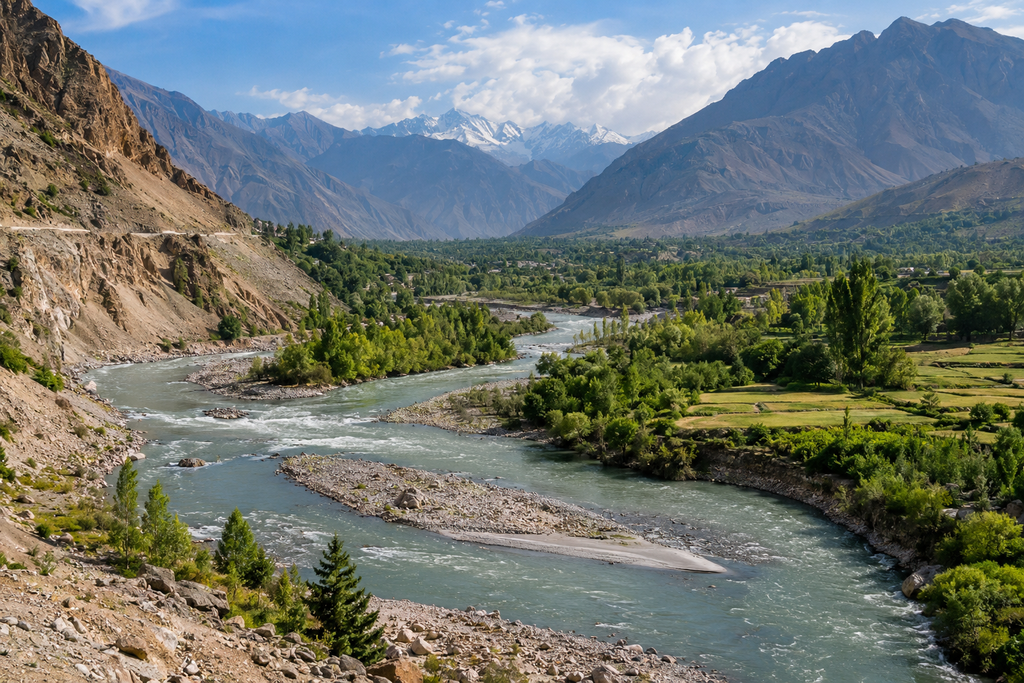
Rivers flowing across flatter land often begin to curve.
These curves are known as meanders.
A meander usually forms because water does not move at exactly the same speed across the entire river channel.
Water often flows faster around the outside of a bend.
The faster water causes more erosion along the outer river bank.
On the inside of the bend, the water is usually slower. This causes sand, mud, and other materials to be deposited.
As erosion continues on one side and deposition continues on the other, the bend becomes larger.
Over time, the river may develop wide looping curves.
Meanders are common in the middle and lower parts of many rivers.
They are a clear example of erosion and deposition working together.
Rivers Can Create Oxbow Lakes
Sometimes a river meander becomes extremely curved.
The two sides of the loop may move closer together as erosion continues.
During a flood or another period of strong water flow, the river may create a new, shorter route across the narrow section of land.
The river then begins flowing through this shorter path.
Sediment may eventually block the entrances to the old loop.
When this happens, the abandoned section of river becomes separated from the main channel.
The result is an oxbow lake.
An oxbow lake usually has a curved shape that shows where the river once flowed.
Over time, the lake may become filled with sediment and vegetation.
This demonstrates that the path of a river is not always permanent.
A river can move across the landscape and leave old channels behind.
Rivers Build Floodplains
Floodplains are wide, flat areas of land located beside rivers.
They are often created over long periods by repeated flooding and deposition.
When a river floods, water spreads beyond its normal channel and moves across the surrounding land.
As the floodwater slows down, it deposits fine materials such as silt and mud.
These materials can build up gradually.
Repeated floods can create broad areas of fertile soil.
This is why many ancient civilizations developed near major rivers. River valleys and floodplains often provided water and rich soil for agriculture.
However, floodplains can also be dangerous places to build homes because they naturally experience flooding.
The same process that creates fertile land can also cause serious damage when people build too close to a river.
How Natural Levees Form
During floods, rivers can also create natural raised banks known as levees.
When a river overflows, the water suddenly slows down as it spreads across the floodplain.
Heavier sand and sediment are deposited close to the river channel.
Finer material travels farther away.
After many floods, the heavier material can build up along the river banks.
This gradually creates raised areas on both sides of the river.
These natural levees may help contain smaller floods, although very large floods can still flow over them.
Rivers Create Waterfalls
Waterfalls are another dramatic feature created by river erosion.
They often form where a river flows over different types of rock.
Imagine a layer of hard rock lying above softer rock.
The softer rock may erode more quickly than the hard rock.
As erosion continues, the softer layer becomes worn away underneath the harder layer.
Eventually, part of the hard rock may be left hanging over the edge.
When the unsupported rock becomes too heavy, it collapses.
The waterfall then moves slightly upstream.
This process can continue for thousands of years.
As the waterfall retreats, it may leave behind a deep and narrow gorge.
Waterfalls therefore show how differences in rock strength can influence the way a river shapes the land.
Rivers Shape Mountains and Hills
Rivers play an important role in breaking down mountainous landscapes.
Rainfall collects on mountains and flows downhill through small channels.
Over time, these channels deepen.
Streams join together and cut valleys into the mountains.
As valleys become deeper and wider, mountain slopes become separated into ridges and peaks.
Rock falls, landslides, weathering, and river erosion can work together to change the landscape.
Eventually, even large mountain areas can become lower and less steep.
This process takes an extremely long time, but it shows that landscapes are always changing.
Mountains that appear permanent are still being slowly reshaped by water, wind, ice, gravity, and other natural forces.
Rivers Create Deltas
One of the most important examples of river deposition happens where a river reaches a lake or sea.
When river water enters a large body of still water, it slows down.
The river can no longer carry as much sediment, so sand, mud, and other materials begin to settle.
Over many years, this sediment builds up.
Eventually, new land may form around the mouth of the river.
This landform is known as a delta.
Some deltas are enormous and contain many smaller river channels.
The river may divide into several branches as it flows through the deposited sediment.
Deltas are often very fertile because rivers continuously bring fresh sediment into the area.
They can support agriculture, wildlife, wetlands, and large human populations.
However, deltas are also sensitive environments because changes in river flow, sea level, storms, and human activity can affect them.
Why River Sediment Is Important
Sediment is one of the main materials rivers use to reshape landscapes.
It includes tiny clay particles, sand, gravel, and larger pieces of rock.
Some sediment comes from the river channel itself.
Other sediment may enter the river when rain washes soil from nearby slopes.
Landslides can also deliver large amounts of rock and soil into rivers.
Once sediment enters a river, it may travel for a few metres or hundreds of kilometres.
It may be deposited temporarily and then moved again during a flood.
Because of this constant movement, rivers act like natural transport systems for Earth materials.
They move rock from mountains toward plains, lakes, and oceans.
How Floods Change River Landscapes
Floods can cause some of the fastest changes in a river landscape.
During normal conditions, a river may change slowly.
During a major flood, however, the amount and speed of water can increase dramatically.
The river may erode its banks, move large rocks, destroy old channels, and create new paths.
Floodwater can also deposit huge amounts of sediment across nearby land.
In some cases, a single flood can change the position of part of a river.
New sand bars may appear, river banks may collapse, and old channels may be abandoned.
Flooding is therefore a natural part of many river systems.
Although floods can be destructive for people, they also play an important role in shaping natural landscapes.
Human Activities Can Change River Erosion
People have changed many rivers around the world.
Dams, bridges, roads, farms, cities, and artificial river channels can affect how water and sediment move.
A dam can trap sediment that would normally travel downstream.
This may reduce the amount of material reaching floodplains or deltas.
Removing vegetation near a river can increase soil erosion because plant roots normally help hold soil in place.
Construction can also change the direction or speed of water flow.
In some places, people straighten river channels to control flooding or create more land.
However, changing a river can sometimes create new problems elsewhere.
A river is part of a connected natural system. Changing one section can influence areas many kilometres downstream.
Why Rivers Keep Changing
No river stays exactly the same forever.
The amount of rainfall changes from season to season.
Floods occur.
Droughts reduce water levels.
Plants grow along river banks.
Sediment moves.
Rock slowly breaks apart.
Because all these processes continue, river landscapes are constantly changing.
Some changes may happen in a few hours during a flood.
Other changes may require thousands or millions of years.
This difference in timescale is one of the most interesting things about rivers.
A landscape that looks permanent to us may actually be changing every day.
The changes are simply too slow for us to notice easily.
Why Rivers Are Important to the Landscape
Rivers are important because they connect many different parts of the environment.
They move water from high land toward lower areas and eventually toward lakes and oceans.
They transport minerals and nutrients.
They create habitats for plants, fish, birds, and other wildlife.
They form fertile floodplains where people grow crops.
They provide drinking water and support cities, industries, and agriculture.
At the same time, rivers constantly reshape the land through erosion, transportation, and deposition.
Without rivers, many valleys, plains, canyons, waterfalls, and deltas would not exist in the forms we see today.
The Three Main Ways Rivers Change the Land
The entire process of river landscape formation can be understood through three basic ideas.
First, erosion removes material from the land.
Second, transportation carries that material downstream.
Third, deposition places the material somewhere else.
These processes usually happen together.
A river may erode one bank while depositing sediment on another.
It may cut rock from a mountain valley and later deposit that same material hundreds of kilometres away.
This continuous movement slowly transforms the surface of the Earth.
Conclusion
Rivers change the shape of the land through a powerful combination of erosion, transportation, and deposition. From their beginnings in mountains to their final journey into lakes and oceans, rivers constantly interact with the landscape.
Fast flowing rivers can cut deep valleys and canyons into rock. Slower rivers can develop wide meanders and fertile floodplains. Waterfalls can retreat upstream as rock is eroded, while sediment carried downstream can eventually create large deltas.
Floods can reshape river channels quickly, while normal river flow may create major changes over thousands or millions of years.
What makes rivers especially fascinating is that they both destroy and create. They remove soil and rock from one place and use those materials to build new land somewhere else.
The next time you stand beside a river, it may appear peaceful and unchanging. In reality, the river is always working. Every grain of sand it carries, every river bank it erodes, and every piece of sediment it deposits is part of a slow natural process that continually reshapes the surface of our planet.
Rivers are therefore much more than flowing water. They are natural builders, transporters, and sculptors that have helped create the landscapes we see around us today.